CyberShake 3.0: Physics-based Probabilistic Seismic Hazard Analysis
Recent destructive earthquakes including Haiti (2010), Chile (2010), New Zealand (2011), and Japan (2011) highlight the global need for improved seismic hazard information. What can be done to reduce the hazard from these inevitable natural events?
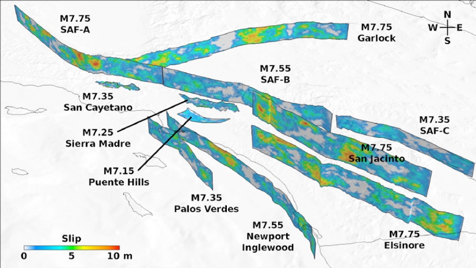
A team led by Thomas Jordan of the Southern California Earthquake Center (SCEC) at the University of Southern California is using INCITE’s high-performance computing resources to calculate a physics-based probabilistic seismic hazard map for California. Dubbed “CyberShake 3.0,” this first-ever 3D wave propagation computational approach shows the seismic hazard implications of the most advanced earthquake forecasts of the U.S. Geological Survey (USGS), the government body that produces the nation’s official seismic hazard forecasts. These forecasts are used nationwide in the development of building codes to minimize seismic risk.
Produced with the cooperation of the USGS and based on its official hazard maps and site-specific hazard curves, CyberShake 3.0 improves on existing models by better capturing the impact of rupture directivity and sedimentary basin structures on earthquake peak ground motions. In addition, CyberShake introduces never-before-available seismic hazard data products including an extended earthquake rupture forecast and shaking duration forecasts. CyberShake 3.0 represents a pioneering effort to use high-performance computing to improve the broadest-impact seismic hazard data products.
While CyberShake research focuses on the well-studied, seismically vulnerable region of California, the technique is applicable to any seismically active region in the world. A physics-based hazard map for California represents a transition point for seismic hazard and risk calculations, adding value to the world’s most advanced, newest earthquake rupture forecast.


